

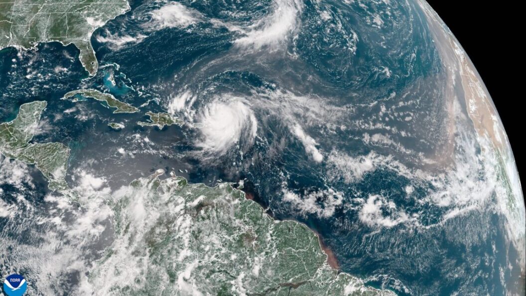
Hurricane Erin: A Record-Setting Storm Intensifies in the Atlantic
Hurricane Erin has made headlines this week as it rapidly intensifies, posing significant challenges for meteorologists and raising concerns about the implications of climate change on Atlantic hurricane activity. With a central pressure that has dropped to 917 mb, Erin is now recognized as the second-most intense Atlantic hurricane in the last 50 years before the end of August, trailing only Hurricane Allen from 1980.
Rapid Intensification
Reports indicate that Erin’s central pressure plummeted from the 990s to the 920s in just a day, leading to projections that it could become the fastest deepening Atlantic hurricane recorded before September 1. This dramatic upgrade has overshadowed previous records, notably that of Hurricane Emily in 2005.
Meteorologist Sam Lillo noted on social media that Erin’s rapid intensification marks a significant milestone for hurricanes occurring at this time of year. "This will make Erin the fastest deepening Atlantic hurricane before Sept 1, beating Emily 2005 by a lot," Lillo stated.
Climate Change Connection
Research substantiates the notion that hurricanes like Erin are becoming more common due to climate change. A study published in Nature Communications highlighted that between 1982 and 2009, the 24-hour intensification rates of the strongest 5% of Atlantic hurricanes increased by approximately 3-4 mph per decade. The study emphasized a connection between human activities and these rising intensification rates.
Scientists widely agree that while the total number of tropical storms may not rise significantly in an increasingly warm world, the conditions will likely yield more intense storms such as Erin. The U.S. government’s Climate.gov supports these findings, stating, "The proportion of severe tropical cyclones (Category 4 & 5) has increased, possibly due to anthropogenic climate change."
Future Projections and Impacts
Despite lower-than-average activity in the tropical Atlantic thus far this season, Erin’s powerful presence signals a shift toward increased storm activity. Meteorologists project that this season’s total activity will soon exceed normal levels, as measured by Accumulated Cyclone Energy, which quantifies a season’s overall intensity and duration of storms. The Atlantic hurricane season typically peaks in early September, making the coming weeks critical.
Looking forward, forecast models indicate a heightened likelihood of additional hurricanes developing over the next two weeks. However, uncertainty remains regarding whether any of these storms will have landfall.
Significance and Conclusion
The development of Hurricane Erin carries profound implications for both meteorological forecasting and climate science. As the hurricane season unfolds, Erin serves as a stark reminder of the potential impacts of climate change on storm intensity and frequency. The trend toward stronger hurricanes could lead to increased risks for coastal areas, necessitating ongoing research and preparedness measures.
The development of Erin raises essential questions about how communities can prepare for more intense storms in the future and underscores the pressing need to address climate change proactively. As scientists continue to study these phenomena, public awareness and readiness will be crucial in minimizing the storm’s potential impacts.